Gudauri
Natural avalanches are possible, human-triggered avalanches are likely. Small avalanches in many areas, or large avalanches in specific areas, or very large avalanches in isolated areas.
The first sunny day since the snowfall brings the danger of loose snow avalanches that may trigger larger slabs on older weaknesses. Wind slabs are also a possibility - and could also trigger deeper layers. Keep your terrain choices smart today.
Forecast issued at: 27 March 2024 08:00
Forecast valid until: 28 March 2024 08:00
Forecaster: Manu Greer
High Alpine
> 2600m
3 Considerable
Dangerous avalanche conditions. Careful snowpack evaluation, cautious route-finding and conservative decision-making essential.
Alpine
2000m - 2600m
3 Considerable
Dangerous avalanche conditions. Careful snowpack evaluation, cautious route-finding and conservative decision-making essential.
Sub Alpine
< 2000m
2 Moderate
Heightened avalanche conditions on specific terrain features. Evaluate snow and terrain carefully; identify features of concern.
Avalanche Problems
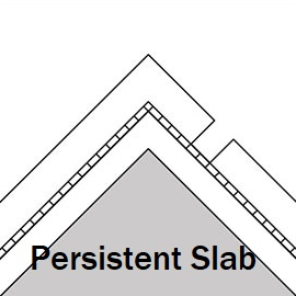
Persistent Slab

Crusts with weak, sugary snow above and below them have been seen in the upper and mid snowpack (below the recent new snow layers). These have failed easily in snow tests. Whumphing has been observed at various aspects and elevations. Large slab avalanches caused by these layers could be triggered by a smaller surface avalanche. These problems will be worse in areas where the snowpack is shallower.
| Sensitivity | The specific avalanche problem type is reactive to human rider triggers. Easy to trigger with ski cut. |
| Distribution | Specific areas, with common characteristics. Evidence for instabilities exists, but it is not obvious and finding it requires careful observations. |
| Trend | No change |
| Confidence | Moderate |
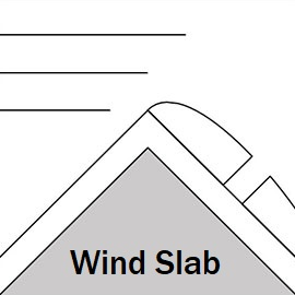
Wind Slab

With lots of loose snow available for transport and moderate SW, W and NW winds recorded, expect build-ups of snow near ridges.
| Sensitivity | The specific avalanche problem type is reactive to human rider triggers. Easy to trigger with ski cut. |
| Distribution | Specific areas, with common characteristics. Evidence for instabilities exists, but it is not obvious and finding it requires careful observations. |
| Time of Day | All day |
| Trend | No change |
| Confidence | Low |
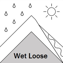
Loose Wet

When the new snow is hit by sun, or when cloud traps in the heat, loose snow avalanches are likely from mid-morning to late afternoon, especially in steep rocky areas. These slides may also be the trigger for a larger slab avalanche on slopes below. Stay out from under steep sunny faces if you see evidence of snow movement, for example 'rollerballs'.
| Sensitivity | The specific avalanche problem type is reactive to human rider triggers. Easy to trigger with ski cut. |
| Distribution | Specific areas, with common characteristics. Evidence for instabilities exists, but it is not obvious and finding it requires careful observations. |
| Time of Day | All day |
| Trend | No change |
| Confidence | Moderate |
Recent Avalanches and Snowpack
Recent avalanche activity:
25 March - Multiple size 3 slabs, N aspect along the ridge E of Arakhveti on or near Mujukhi.
21 March - Natural size 3 storm slab, SW aspect, in Kobe Valley next to the waterfall, likely triggered by loose wet avalanche. Several size 1 to 2 slab avalanches on W and SE aspects with some evidence of step-down between layers.
20 March - Natural size 3 storm slab, S side of Sadzele 3200 m, and another nearby size 3 avalanche on SW side of Konstitucion (Black Ridge) at 3100m. Both of these were likely triggered by smaller loose wet slides from above. Several recent natural slab avalanches on Lomisa Ridge (NE aspect). A report of a probable size 2 skier triggered slide on a shady aspect in Kobe valley. Multiple small loose wet slides on S aspects.
Glide slabs continue to be active on multiple aspects (more commonly E, S and W), some up to size 2. These can release at any time - if you see cracks in the snow, do not stop under these areas!
Snowpack:
Around 80 cm of new snow fell between Thursday night and Monday. The new layer is becoming more stable due to mild temperatures, but the previous snowpack has crusts with and weak facet layers in the upper half. Whumphing and failures in snow tests have been seen recently. Wind yesterday from SW and W will have formed slabs near ridges in sheltered areas. Cornices in some locations are getting large (particularly on Lomisa Ridge); treat them with respect.
Weather
Wednesday is sunny with a few clouds. Light to moderate W winds. Freezing level 1700 m.
Disclaimer
Our avalanche forecasters are internationally qualified and experienced professionals, and data is provided by skilled observers. We encourage you to make your own observations and decisions, without relying solely on our forecast, since any forecast is a generalised 'best guess', and in certain cases it might be inaccurate. We can not be held liable for any actions you take in the backcountry that may result in injury, loss or death.