Gudauri
Natural avalanches are possible, human-triggered avalanches are likely. Small avalanches in many areas, or large avalanches in specific areas, or very large avalanches in isolated areas.
Up to 40 cm of new snow with variable winds make storm snow avalanches likely on steep terrain. There are also layers deeper in the snowpack that could be set off by a smaller avalanche. The snowpack needs time to adjust to the extra weight, so avoid steep terrain for at least 24 hours after the storm is finished. Warm temperatures and sun bring the risk of wet snow avalanches on solar aspects even to high elevations.
Forecast issued at: 16 March 2024 08:00
Forecast valid until: 18 March 2024 08:00
Forecaster: Manu Greer
High Alpine
> 2600m
3 Considerable
Dangerous avalanche conditions. Careful snowpack evaluation, cautious route-finding and conservative decision-making essential.
Alpine
2000m - 2600m
3 Considerable
Dangerous avalanche conditions. Careful snowpack evaluation, cautious route-finding and conservative decision-making essential.
Sub Alpine
< 2000m
2 Moderate
Heightened avalanche conditions on specific terrain features. Evaluate snow and terrain carefully; identify features of concern.
Avalanche Problems
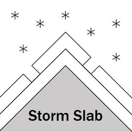
Storm Slab

New snow and variable winds will mean there are many places you could start avalanches, where the snow might not be well-bonded to the previous surface. Stay away from steep areas and give the new snow at least 24 hours to settle. These storm snow avalanchces can also set off weak layers deeper in the snowpack.
| Sensitivity | The specific avalanche problem type is reactive to human rider triggers. Easy to trigger with ski cut. |
| Distribution | Many locations. Evidence for instabilities is frequently found, in many locations. |
| Time of Day | All day |
| Trend | Deteriorating |
| Confidence | Moderate |
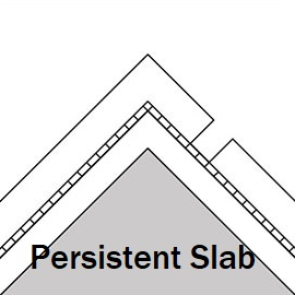
Persistent Slab

Weak, sugary snow has been found in the upper and mid snowpack at higher elevations on various aspects. Large slab avalanches could be triggered by the additional weight of new snow or by a smaller surface avalanche. These problems will be worse in the north of the region and areas where the snow is shallower.
| Sensitivity | The specific avalanche problem type is difficult to trigger with a human rider. |
| Distribution | A few, isolated locations; evidence for instabilities is rare and hard to find. |
| Trend | No change |
| Confidence | Moderate |
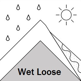
Loose Wet

Wet snow below 2000 m, a high freezing level and strong sun in the morning means loose wet slides are likely on the S half, even at higher eleavations as the new snow heats up on steep faces.
| Sensitivity | The specific avalanche problem type is reactive to human rider triggers. Easy to trigger with ski cut. |
| Distribution | Specific areas, with common characteristics. Evidence for instabilities exists, but it is not obvious and finding it requires careful observations. |
| Time of Day | All day |
| Trend | Deteriorating |
| Confidence | Moderate |
Recent Avalanches and Snowpack
Recent avalanche activity: None reported in the last 48 hours
Glide slabs continue to be active on multiple aspects (more commonly E, S and W), some up to size 2. These can release at any time - if you see cracks in the snow, do not stop under these areas!
Snowpack:
Up to 40 cm of new snow has fallen at high elevations, with Easterly winds at the start of the storm, with winds then becoming light at 2600 m (although higher up our weather station stopped recording for a time). The new snow is sitting on a recent melt-freeze crust in many areas, even on N aspects, and above a snowpack that has weaknesses in the mid and upper sections. Surface hoar and facets around crusts were previously found at high elevations on shady aspects. Whumphing was heard on a NW slope near Bidara, and recent testing found easy failures on these weak layers. These weaknesses are worse on shady aspects at high elevations and where the snow is shallow (less than about 1.5 m).
Weather
A fine morning on Sunday with some cloud later. Light and variable winds. Freezing level 2100 m in the morning dropping to 1400 at night.
Disclaimer
Our avalanche forecasters are internationally qualified and experienced professionals, and data is provided by skilled observers. We encourage you to make your own observations and decisions, without relying solely on our forecast, since any forecast is a generalised 'best guess', and in certain cases it might be inaccurate. We can not be held liable for any actions you take in the backcountry that may result in injury, loss or death.