Gudauri
Natural avalanches are unlikely, human-triggered avalanches are possible. Small avalanches in specific areas, or large avalanches in isolated areas.
Winds have moved recent new snow onto sheltered slopes, creating wind slabs. While the wind slabs will start to settle with milder temperatures, they will take another day or two to stabilize. Avoid steep, unsupported eastern slopes. Be also cautious on slopes with shallow snowpacks, as there are buried crust/facet combinations that may react to skiers. SW, S and SE slopes in lower elevations will also get a lot of radiation tomorrow, with some potential for wet avalanches on steep slopes in the afternoon.
Forecast issued at: 8 February 2024 21:00
Forecast valid until: 9 February 2024 21:00
Forecaster: Peter S
High Alpine
> 2600m
2 Moderate
Heightened avalanche conditions on specific terrain features. Evaluate snow and terrain carefully; identify features of concern.
Alpine
2000m - 2600m
2 Moderate
Heightened avalanche conditions on specific terrain features. Evaluate snow and terrain carefully; identify features of concern.
Sub Alpine
< 2000m
2 Moderate
Heightened avalanche conditions on specific terrain features. Evaluate snow and terrain carefully; identify features of concern.
Avalanche Problems
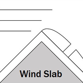
Wind Slab

Wind slabs will be forming, especially in the high alpine near ridges. There are already previous wind slabs in these areas that could still be reactive. Avoid steep and unsupported eastern slopes and keep in mind potential cross-loading on other aspects than indicated.
| Sensitivity | The specific avalanche problem type is reactive to human rider triggers. Easy to trigger with ski cut. |
| Distribution | Specific areas, with common characteristics. Evidence for instabilities exists, but it is not obvious and finding it requires careful observations. |
| Time of Day | All day |
| Trend | Improving |
| Confidence | Moderate |
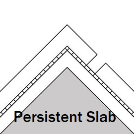
Persistent Slab

Weak, facetted snow layers have been observed in the region at all elevation bands, around buried crusts and in areas with shallow snow depth. If these weak layers have enough dense snow above them, medium (sz 2) and possibly large (3) avalanches could be triggered. While the problem is worse in the north of the region where the snow is shallower than south of the main range (pass), we also have recent evidence of crust/facet combinations on southern-southeastern aspects below 2200. Be cautious in shallower snowpacks, and take "whumpfs" as a clear sign of instability - and the presence of a weak layer that can easily be triggered in steeper terrain.
| Sensitivity | The specific avalanche problem type is difficult to trigger with a human rider. |
| Distribution | Many locations. Evidence for instabilities is frequently found, in many locations. |
| Time of Day | All day |
| Trend | No change |
| Confidence | Moderate |
Recent Avalanches and Snowpack
Recent avalanche activity:
7 February - multiple size 2 - 3 wind / storm slab avalanches seen Lomisa - Miketi ridgeline, E aspects 2100 - 2300m. 4 February - size 1 wind slab near Sioni valley, 2000m, N aspect - failed on weak snow near the ground.
Glide slabs continue to be active on multiple aspects below about 2600m, some up to size 2.
Snowpack: 40 - 50 cm of new snow fell on Tuesday 7th, with W winds at times at high elevations Older wind slabs on the E and NE faces were found to be reactive a couple of days ago. Melt-freeze crusts can be found at lower elevations and sunny aspects, and there can be weak snow layers around these crusts. In northern areas (North of Kobi valley), the snowpack is thinner and critical weaknesses around crusts, and at the ground, have been found. Watch out for weak, sugary (faceted) snow in areas where the snow is shallow, and crust/facet layers. Check out recent snow profiles (or add your own!) at snowpilot.org
Weather
Partly cloudy on Friday. light snow possible, moderate W winds up high, freezing level rising to 2050.
Disclaimer
Our avalanche forecasters are internationally qualified and experienced professionals, and data is provided by skilled observers. We encourage you to make your own observations and decisions, without relying solely on our forecast, since any forecast is a generalised 'best guess', and in certain cases it might be inaccurate. We can not be held liable for any actions you take in the backcountry that may result in injury, loss or death.