Gudauri
Natural avalanches are unlikely, human-triggered avalanches are possible. Small avalanches in specific areas, or large avalanches in isolated areas.
Fresh wind slabs reactive to skier-triggering have formed on NW, N, NE and possibly E aspects. Wind slabs that formed on 31 Jan remain reactive due to a buried layer of loose precipitation particles. Persistent weak layers that could exist at higher elevations should be investigated.
Forecast issued at: 3 February 2024 23:00
Forecast valid until: 4 February 2024 23:00
Forecaster: Manu Greer, Peter S
High Alpine
> 2600m
2 Moderate
Heightened avalanche conditions on specific terrain features. Evaluate snow and terrain carefully; identify features of concern.
Alpine
2000m - 2600m
2 Moderate
Heightened avalanche conditions on specific terrain features. Evaluate snow and terrain carefully; identify features of concern.
Sub Alpine
< 2000m
1 Low
Generally safe avalanche conditions. Watch for unstable snow on isolated terrain features.
Avalanche Problems
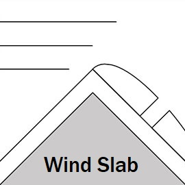
Wind Slab

Fresh wind slabs are reactive to skier triggering; wind slabs that formed on 31 Jan remain reactive due to a buried layer of loose precipitation particles.
| Sensitivity | The specific avalanche problem type is reactive to human rider triggers. Easy to trigger with ski cut. |
| Distribution | Specific areas, with common characteristics. Evidence for instabilities exists, but it is not obvious and finding it requires careful observations. |
| Time of Day | All day |
| Trend | Improving |
| Confidence | Moderate |
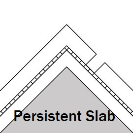
Persistent Slab

Whumphing was heard in a couple of places recently (Lomisa, Kudebi), and new avalanches slid on a crust layer under the recent snowfall that has facets above it in some places. This layer may extend into the subalpine. Other weak layers associated with melt-freeze crusts or density changes have been found around the forecast area, and cold temperatures are making all these layers weaker where the snowpack is shallow (less than about 1.5m)
| Sensitivity | The specific avalanche problem type is difficult to trigger with a human rider. |
| Distribution | Specific areas, with common characteristics. Evidence for instabilities exists, but it is not obvious and finding it requires careful observations. |
| Time of Day | All day |
| Trend | Deteriorating |
| Confidence | Moderate |
Recent Avalanches and Snowpack
Recent avalanche activity:
31 Jan (suspected, exact date unknown): Size 1 windslabs on S aspects, 3200 m and 2900 m, little and big Sadzele.
Glide slabs continue to be active on multiple aspects below about 2600m, some up to size 2.
27th January - mulitple natural size 1 loose dry avalanches in high alpine, some happened mid-storm. Multiple natural storm slabs, wind slabs and glide slabs up to size 2 Lomisa - Miketi area 2000 - 2400m, SE,E and NE
Snowpack: While the snow from last weekend has settled, recent winds have created fresh, reactive wind slabs. There is a melt-freeze crust down about 40cm, below 2600m - 3000m, depending on aspect. Facets have been seen above this crust, SE aspect 2900m - these produced whumphing. The deeper snowpack is generally stable, especially at lower elevations (below 2000m) due to recent warming. In some areas above 2600m, there is weak, faceted snow in shallow rocky areas near ridges, and crust/facet layers have been found. Check out recent snow profiles (or add your own!) at snowpilot.org
Weather
Cool air tempertures have continued but the sun has had an effect in the last couple of days. Sunday is forecasted sunny but cold, with temperature at 2200 m ranging from -9° to -15°.
Disclaimer
Our avalanche forecasters are internationally qualified and experienced professionals, and data is provided by skilled observers. We encourage you to make your own observations and decisions, without relying solely on our forecast, since any forecast is a generalised 'best guess', and in certain cases it might be inaccurate. We can not be held liable for any actions you take in the backcountry that may result in injury, loss or death.